#30DayMapChallenge
A cartographic series exploring Madison WI (and Dane County), following the 30 prompts for the month of November provided by @tjukanov, known as the #30DayMapChallenge on Twitter.
Day 1
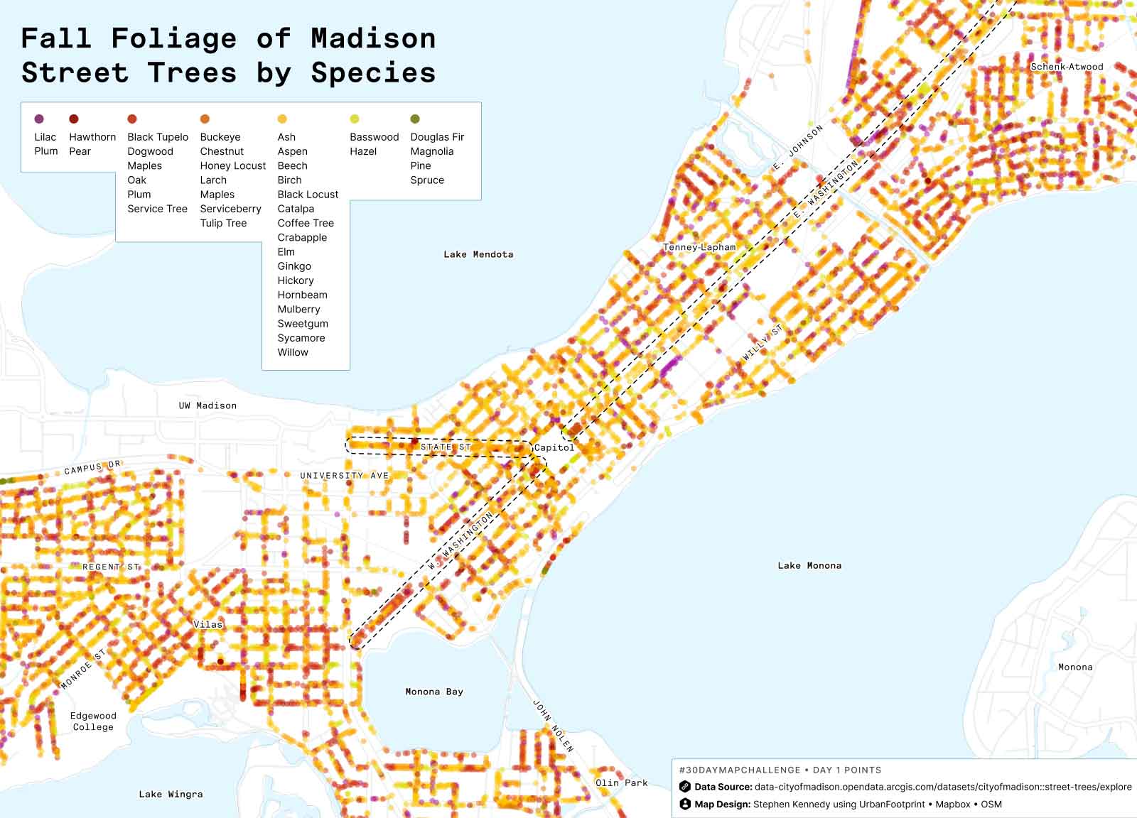
Points
Pulled the street tree dataset from @CityofMadison and categorized each species by fall foliage color.
Tweet thread
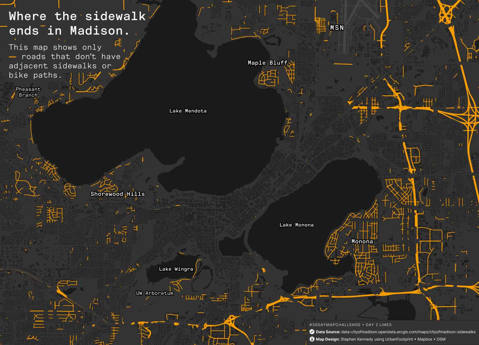
Day 2
Lines
A quick map using @CityofMadison sidewalk and bike path data to visually mask over the road network. Shows areas with less walking infrastructure.
Tweet thread
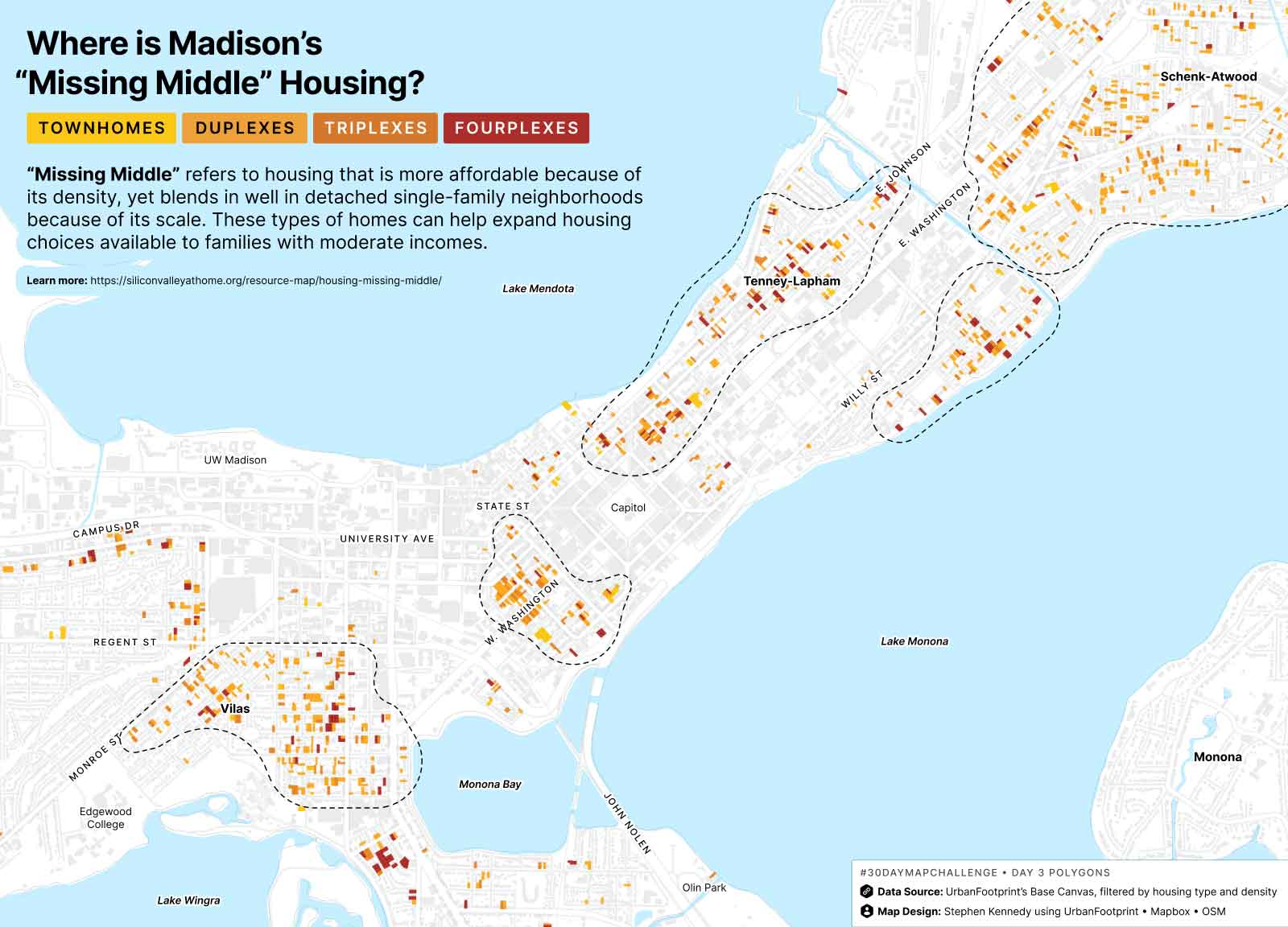
Day 3
Polygons
Wanted to see where #MissingMiddle housing types and density already exists in Madison. First filtered land use data from UrbanFootprint down to parcels w/ townhomes or that had 2-4 dwelling units. Then filtered out parcels that didn’t fall between 16-30 DUs/acres.
I was mostly curious to see which areas already contained these housing types + density from a morphological perspective. There seems to be some concentration in Vilas, W Wash, along E Johnson, south of Willy St. And quite a spread around Atwood.
Tweet thread
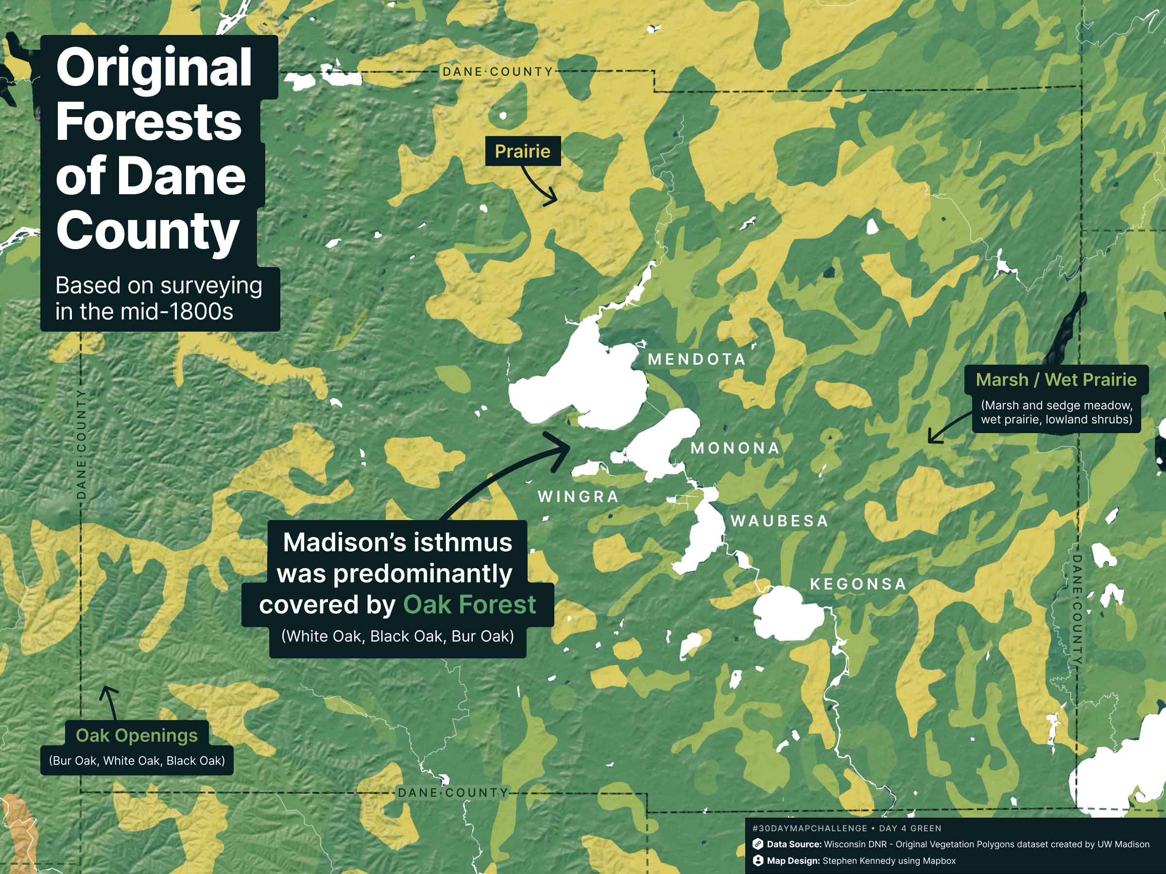
Day 4
Green
Before the Ho-Chunk Nation was displaced and the area was proposed as the state capital, what was the landscape like? Data from @WDNR @UWMadison indicates oak forest w/ prairie + marsh, as surveyed mid-1800s.
Tweet thread
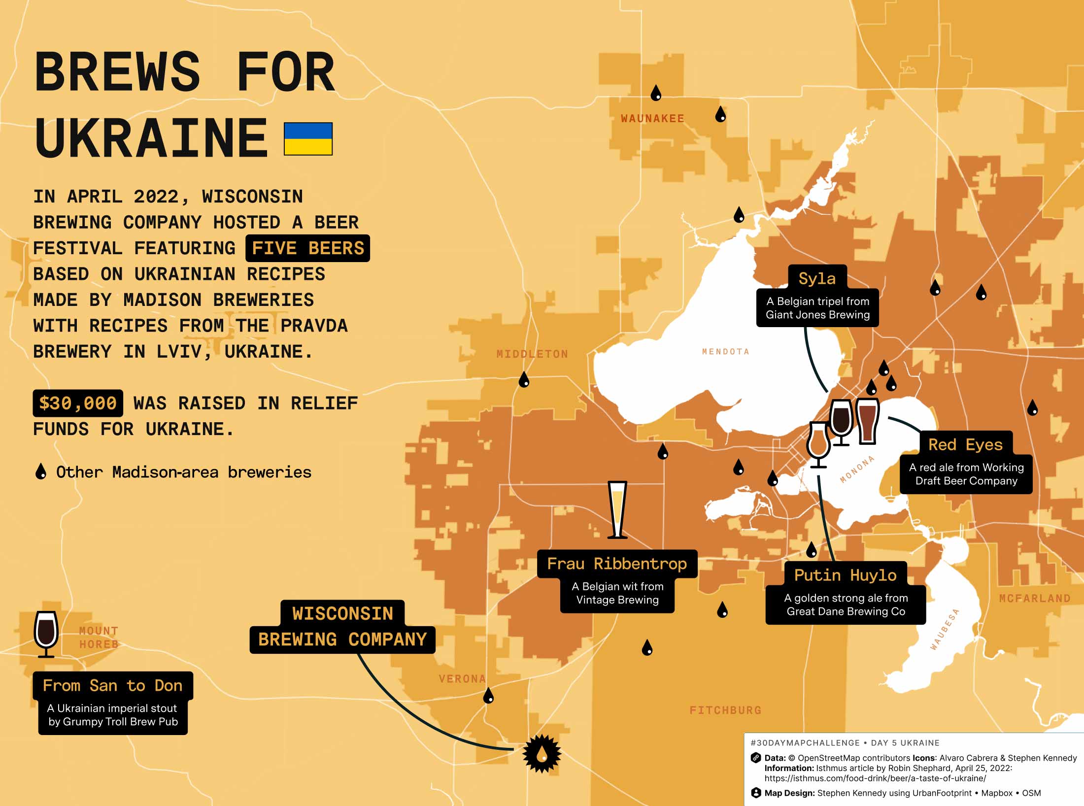
Day 5
Ukraine
Last April, @WisBrewingCo hosted a fundraiser featuring 5 Ukrainian beers made by Madison breweries! $30k raised in relief funds—grab your next 🍻at @GrumpyTrollBrew @greatdanepub @GiantJonesBeer @WorkingDraftBC @vintagebrewer
Tweet thread
Day 6
Network
Used power lines from @openstreetmap to create a fictional #transit network for squirrel commuting throughout the greater Madison WI area. 🐿
Tweet thread
Day 7
Raster
Overlayed new buildings by decade built to animate the transformation of farmland to city. Aerial image from 1937 @UWDigiCollec. Building footprints and parcel reference data from @UFPlatform.
Tweet thread
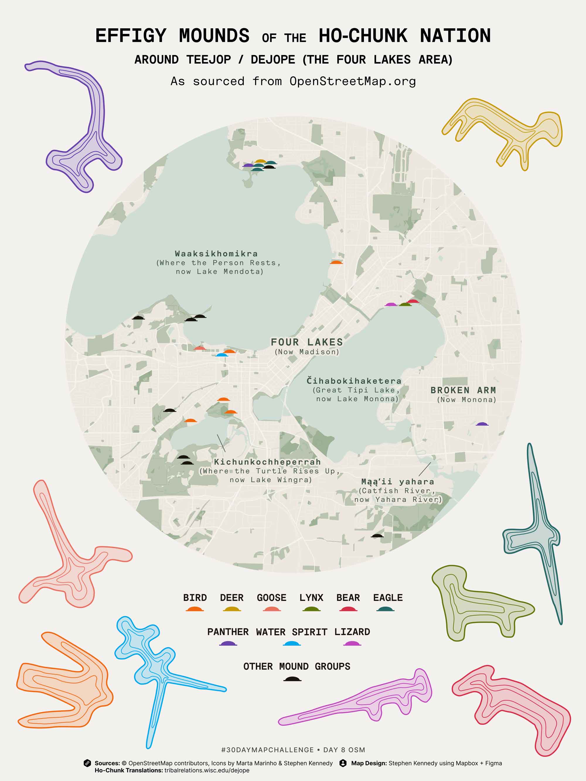
Day 8
OSM
Madison has more effigy mounds than any other city in the US, made by the Ho-Chunk Nation. But I only found 24 on @openstreetmap — should we organize a Madison mapathon to add more?
Tweet thread
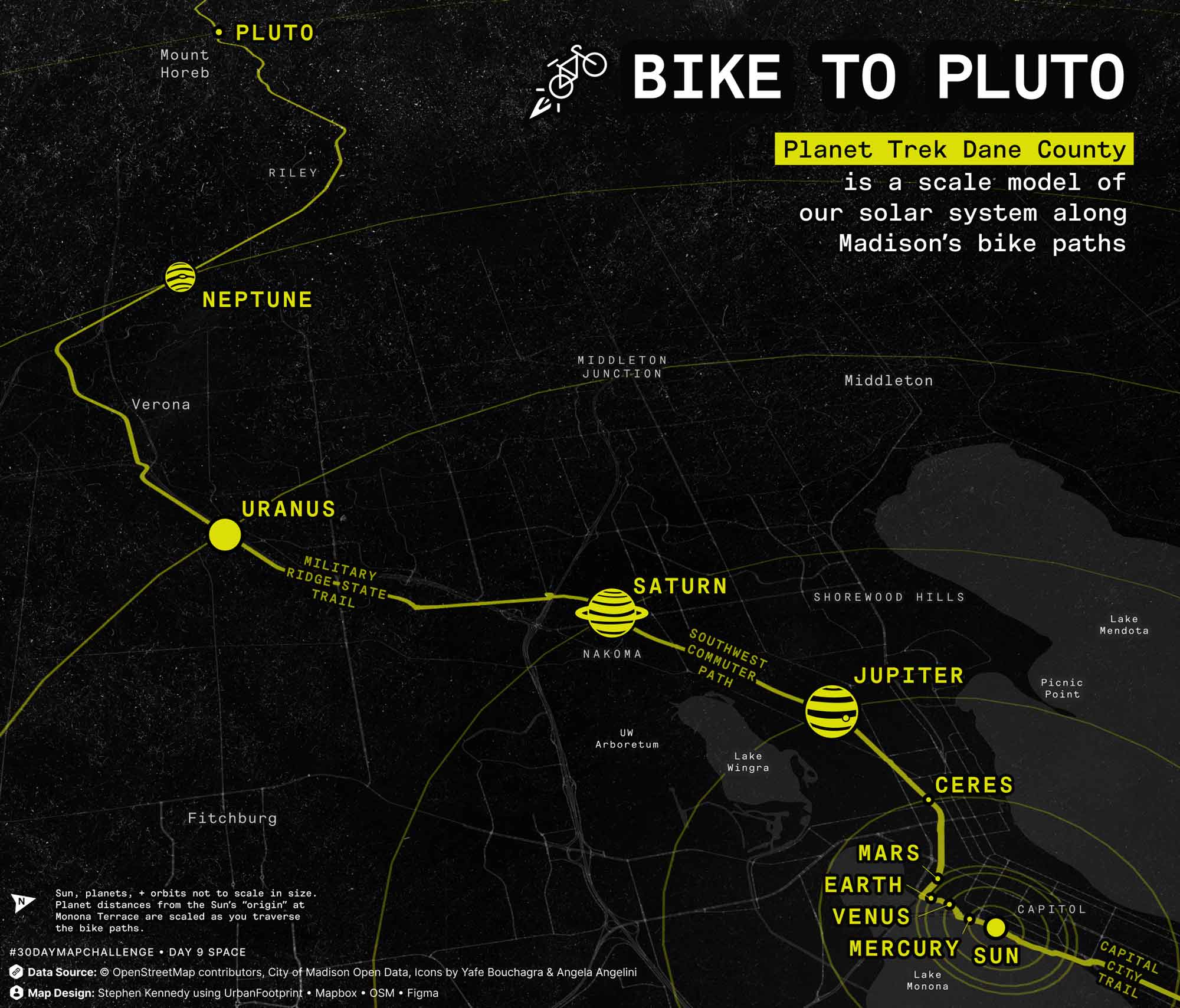
Day 9
Space
You can bike a scaled model of our solar system from @MononaTerrace to Mt Horeb—about 23 mi representing the 5.9B km from the 🌞 to Pluto! Planet Trek Dane County by @UWSpacePlace
Tweet thread
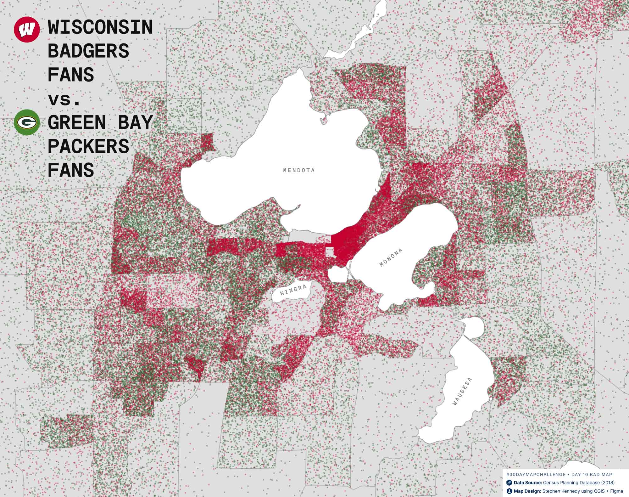
Day 10
A Bad Map
I give this map an "F" for...
❌ Fake data
❌ Failing red-green color blind accessibility
❌ Football...not a huge fan (sorry, Wisconsin!)
Tweet thread
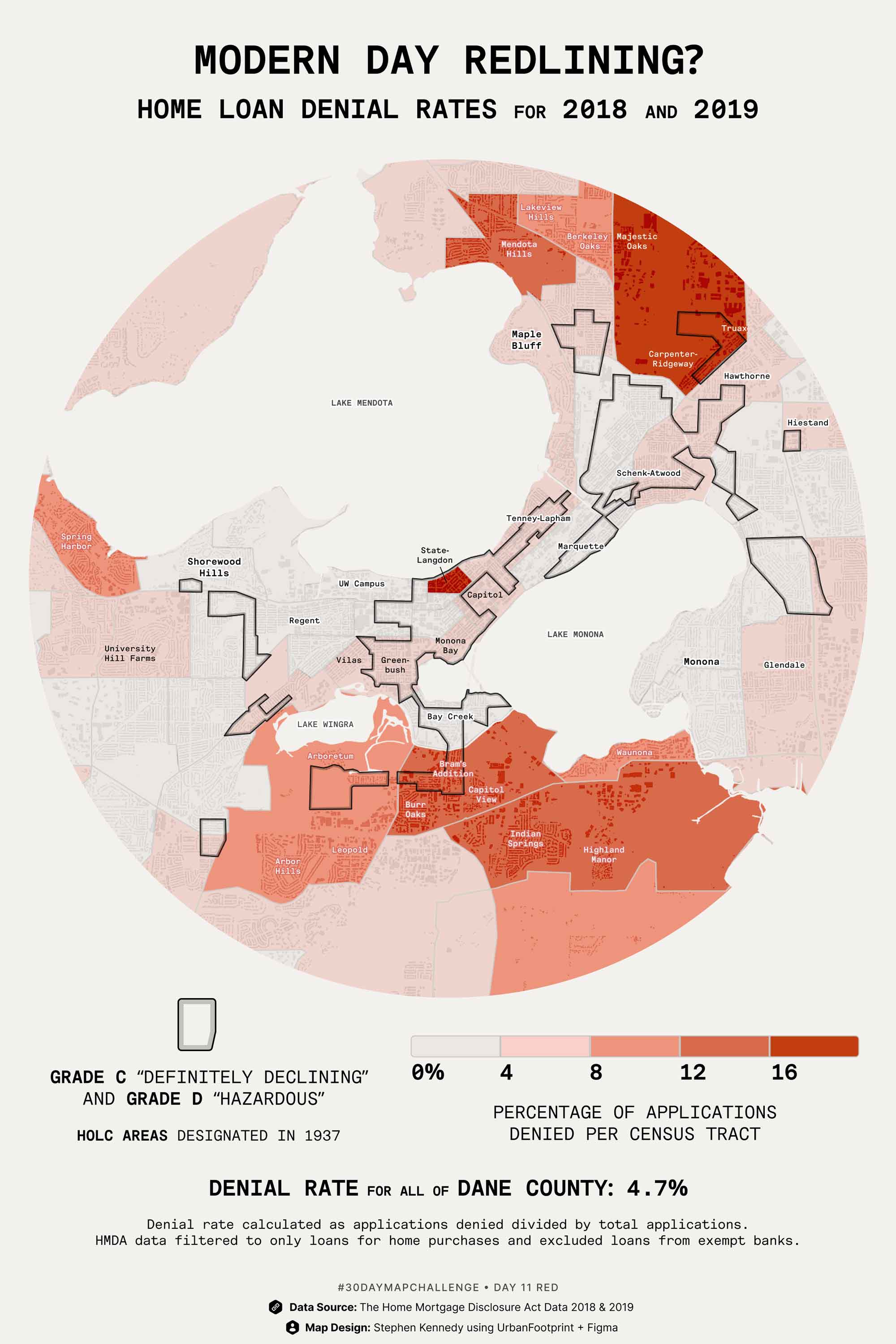
Day 11
Red
Denial rates for home loans in 2018/19 by census tract, with HOLC redlined areas (Grade C + D) from 1937 outlined as an overlay. #HMDA data from @CFPB. Mapped with @qgis @UFPlatform.
Tweet thread
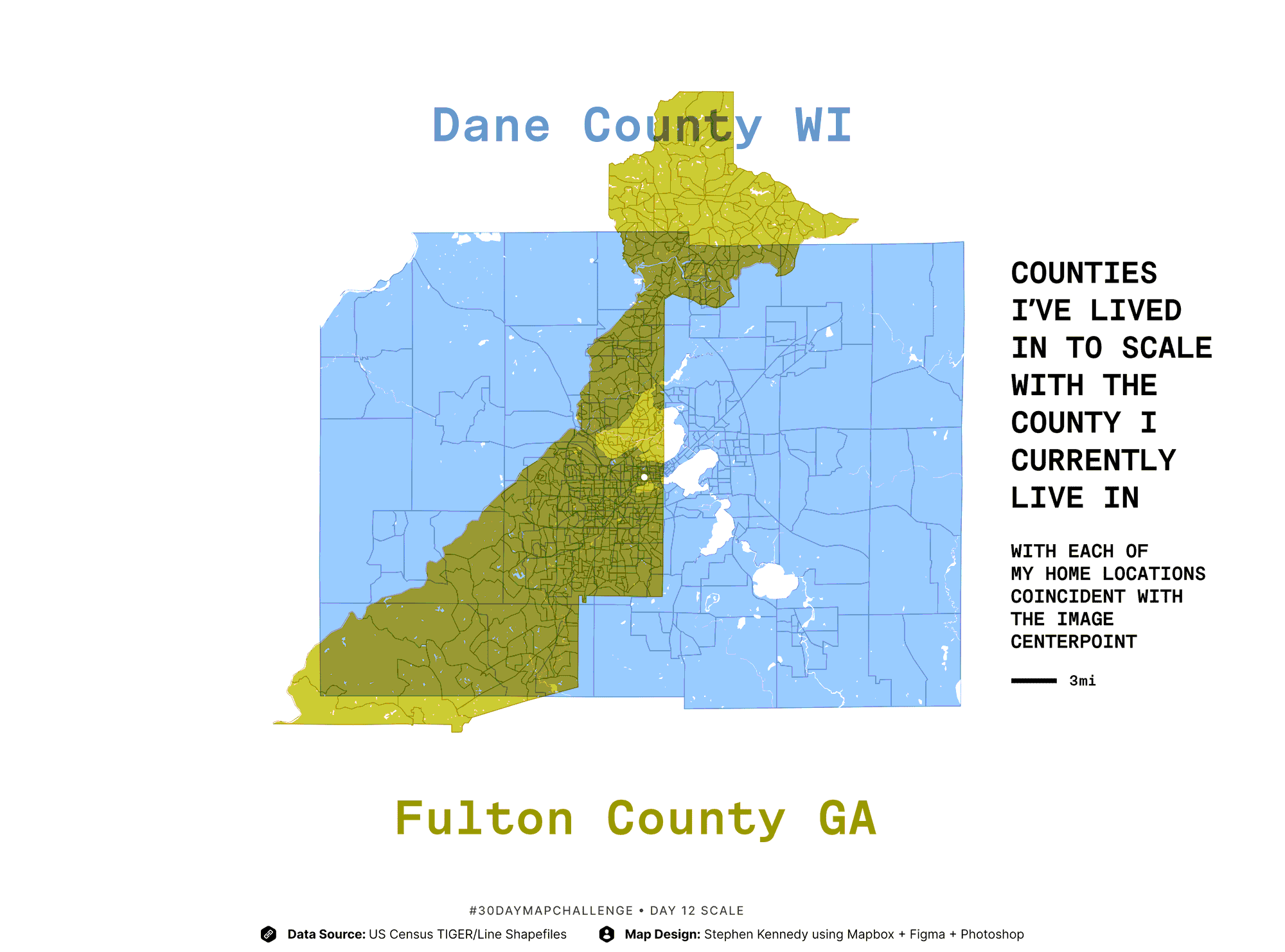
Day 12
Scale
Counties I've lived in to scale with the county I currently live in. With each of my home locations coincident with the image centerpoint.
Tweet thread
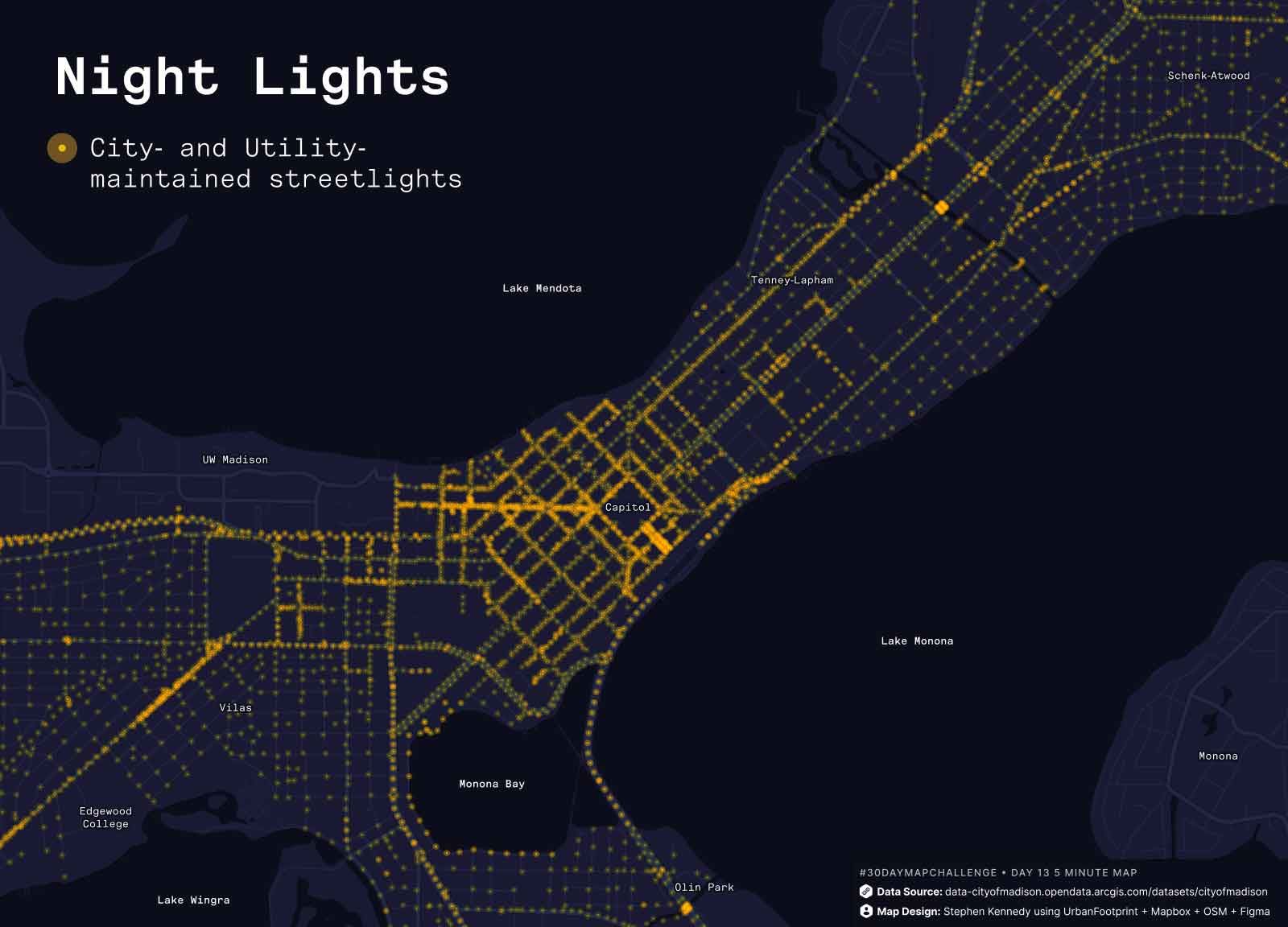
Day 13
5 Minute Map
Quickly mapped streetlights from @CityofMadison data portal, added a quick glow in @UFPlatform on a dark basemap, and played with some opacity effects in Figma. ⏲
Tweet thread
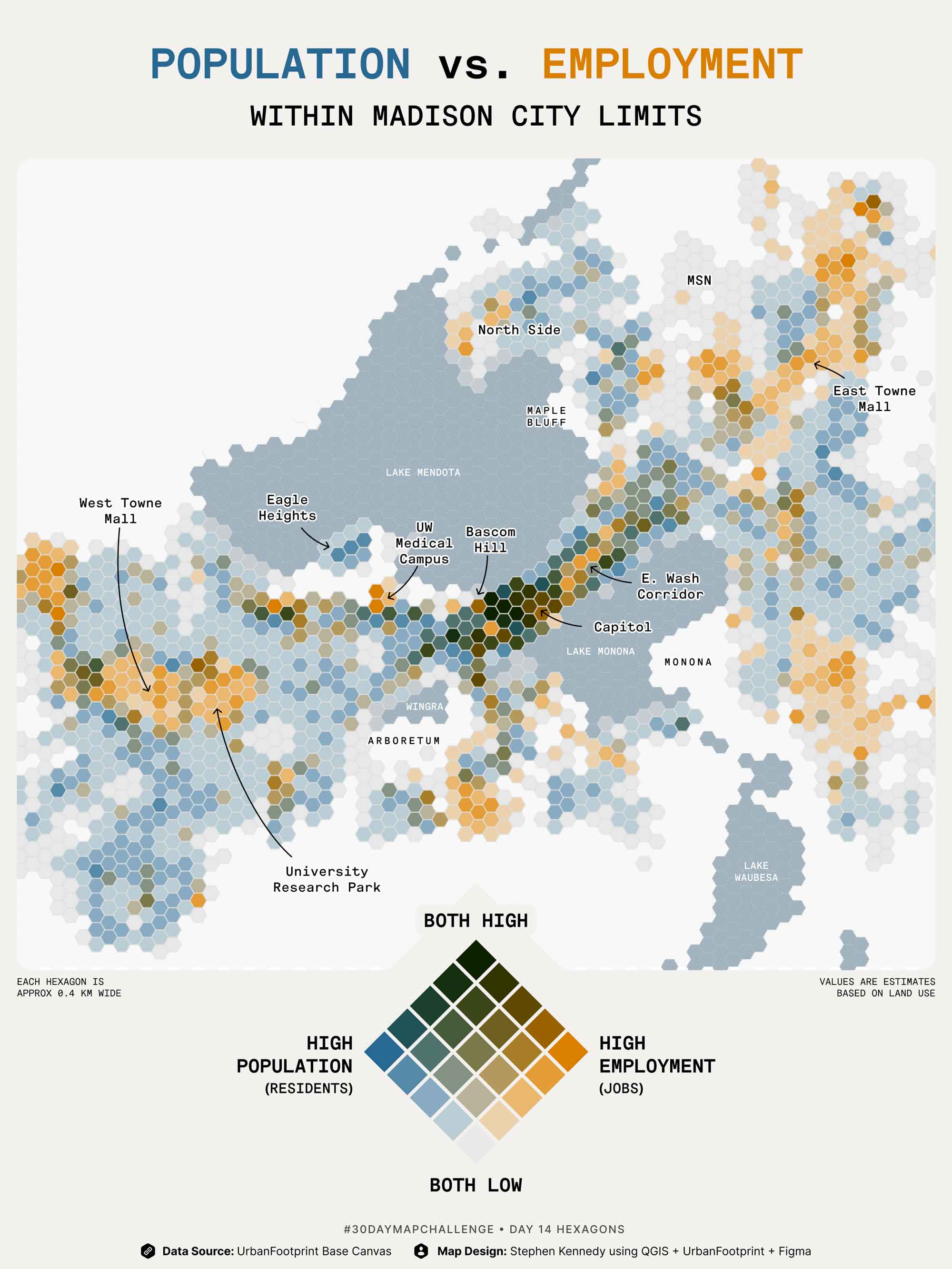
Day 14
Hexagons
Hexbin map made in QGIS with resident + job estimates based on @UFPlatform’s land use data.
Tweet thread
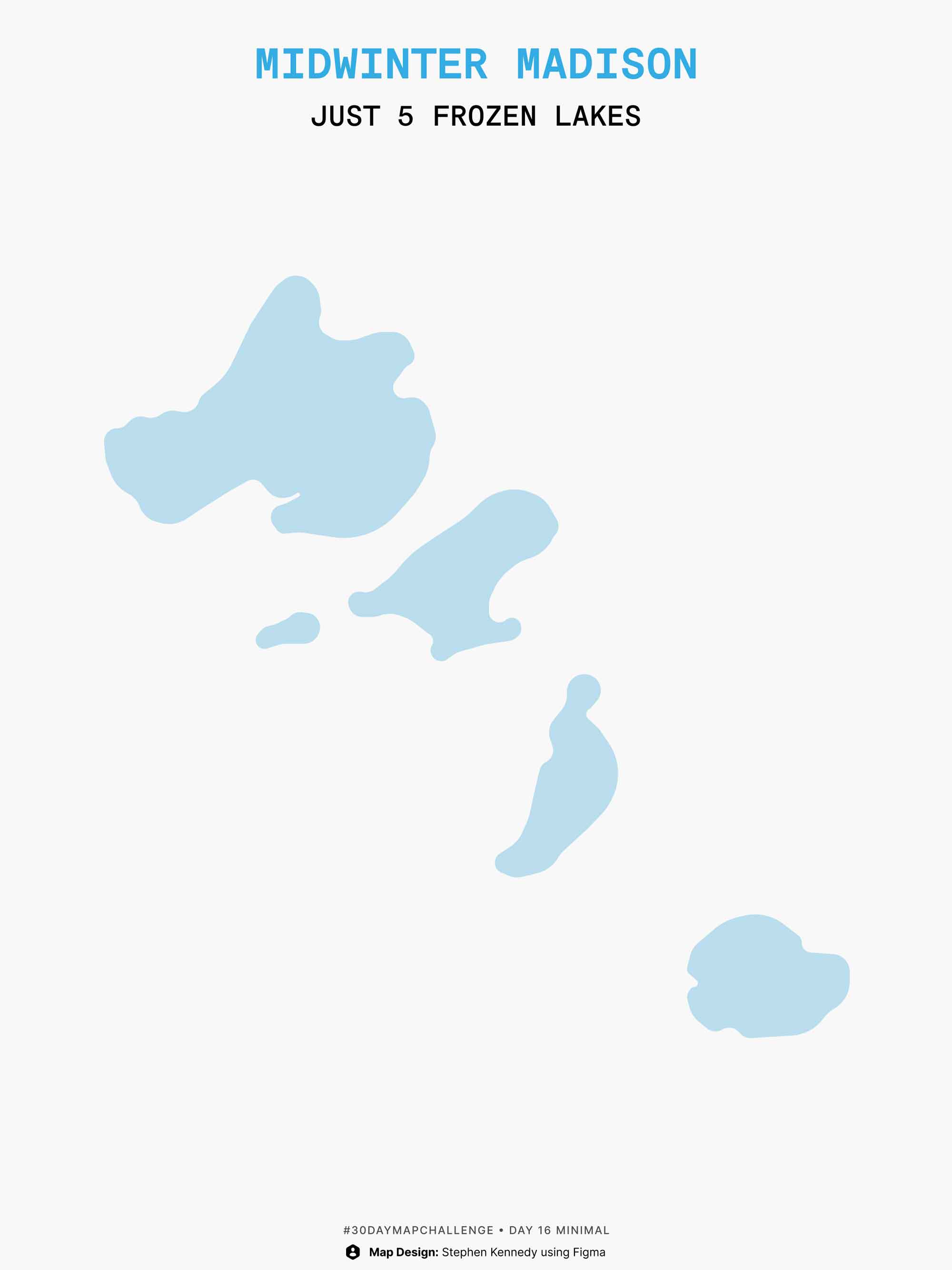
Day 15
Food
Mapped with @UFPlatform, showing just parcels with agricultural land use. 🌽
Tweet thread

Day 17
Map w/o a Computer
What defines our neighborhood? Asked neighbors which features are the boundaries of our Madison neighborhood. Cut their answers out of colored vellum & overlaid those on a drawing of the boundaries to show overlapping areas.
Tweet thread
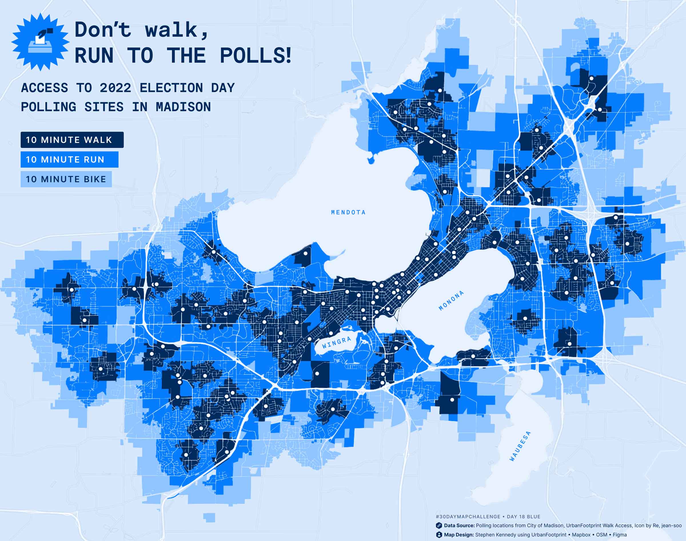
Day 18
Blue
Walk + run + bike access sheds to @CityofMadison's 108 polling locations. Calculated by @UFPlatform walk access module. Well, get there however you can! GO VOTE, Wisconsin!
Tweet thread
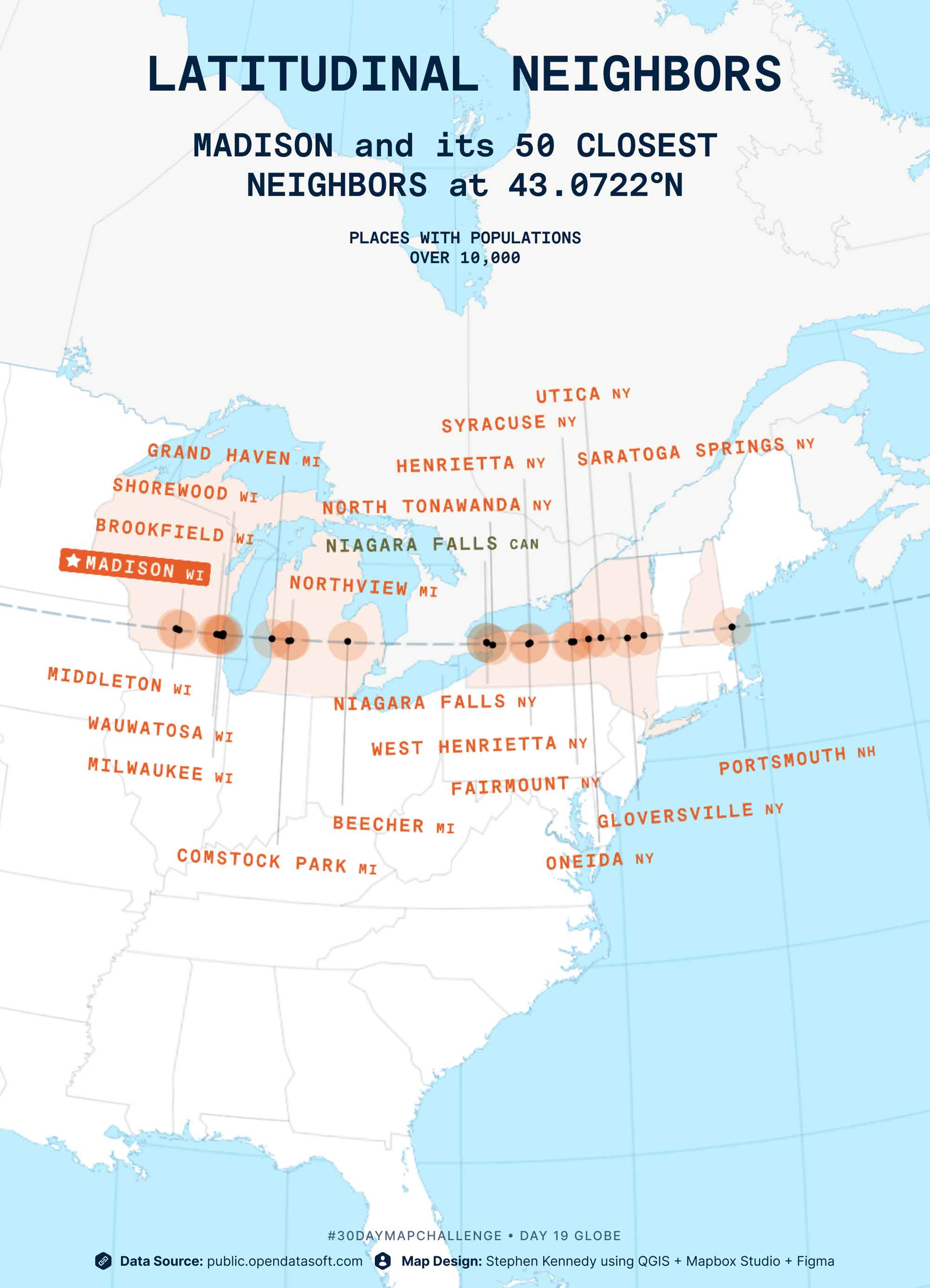
Day 19
Globe
Madison and its 50 closest neighbors, in terms of latitude (43.0722° N).
See the interactive map
Tweet thread

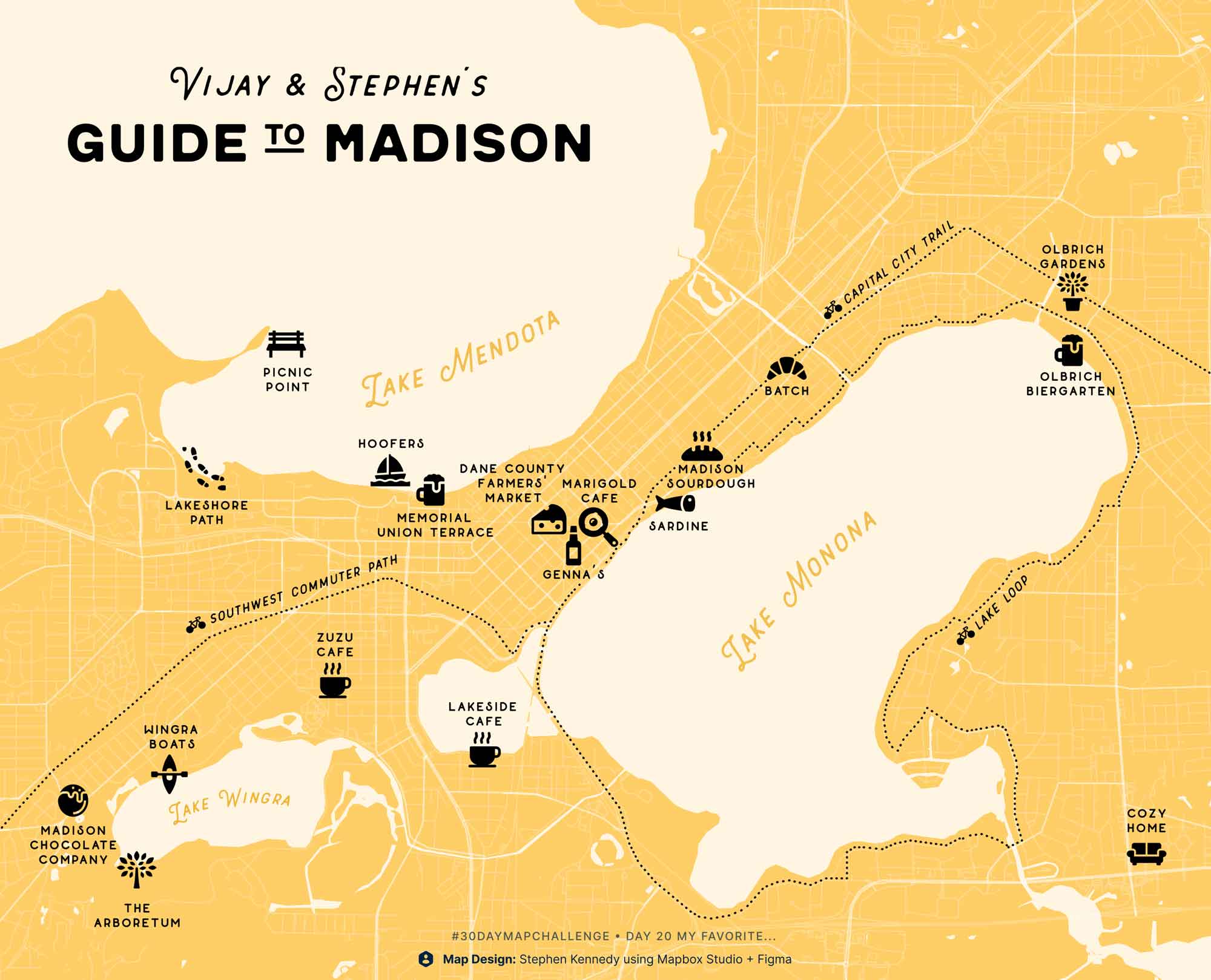
Day 20
My favorite…
Only map so far that predates the challenge—this one was from our wedding last October. A map to share our favorite spots in our new hometown with all our visitors! 🍁
Tweet thread
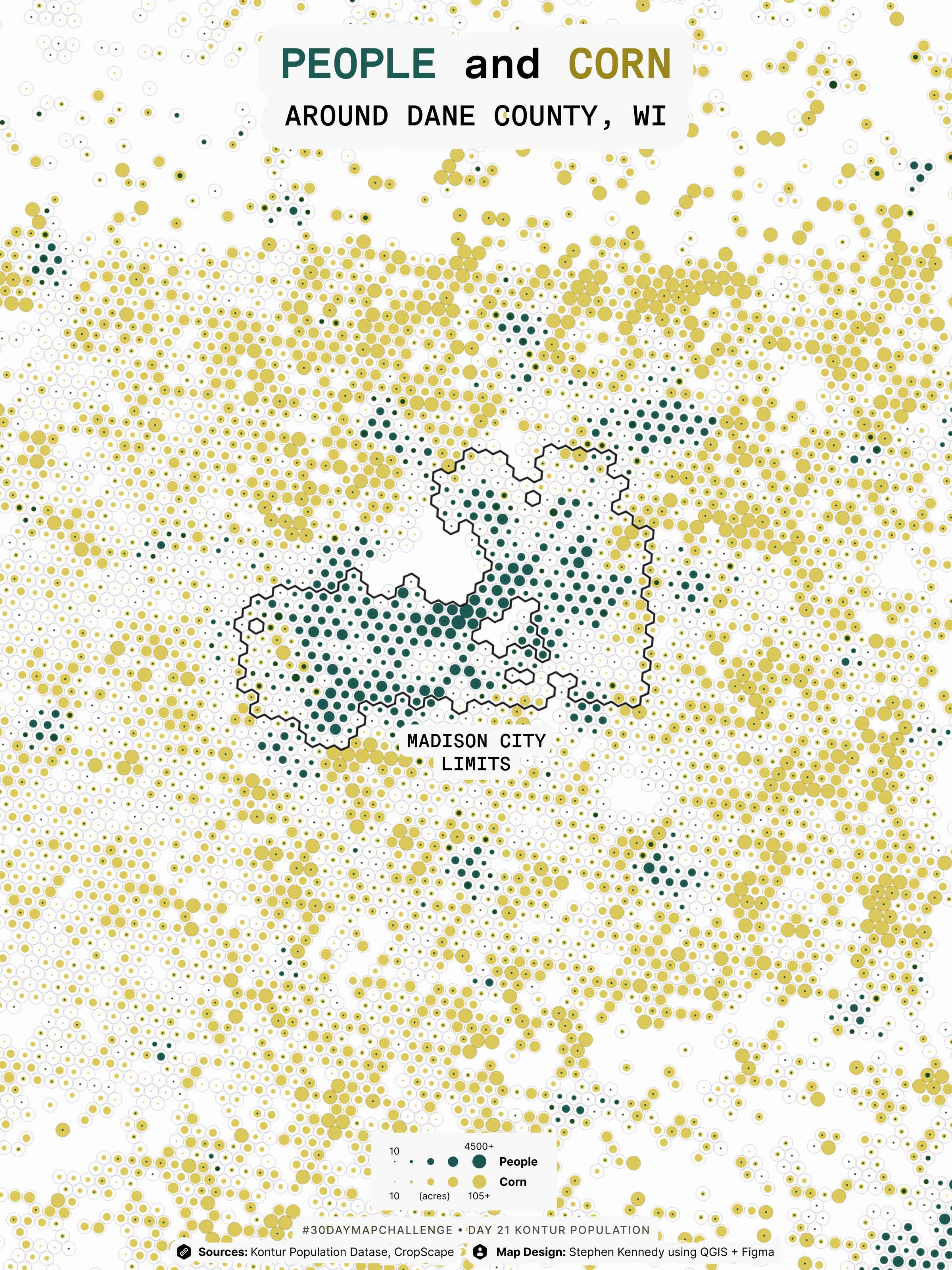
Day 21
Kontur Population
Decided to add a comparative layer to make it a bit more interesting than just pop! Pulled raster crop coverage data via CropScape.
Tweet thread
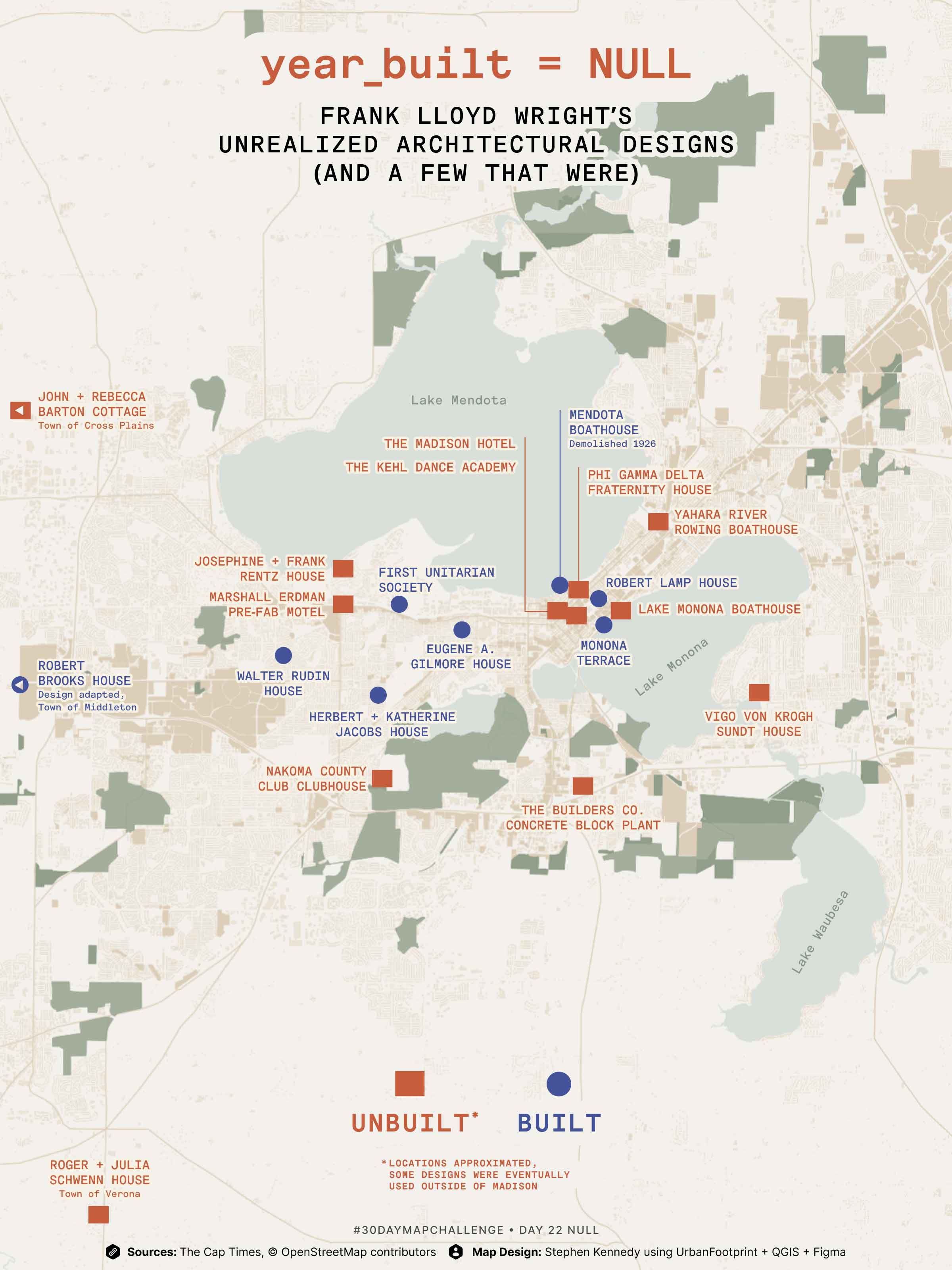
Day 22
NULL
Frank Lloyd Wright designed a total of 33 buildings for his hometown of Madison WI between 1893-1959. But nearly half went unbuilt (at least in the location of their original design). Based on 2017 article by @CapTimes
Tweet thread
Day 23
Red
At which bike crossings will you encounter the most/least cars? Road segment counts from @CityofMadison as scaled symbols at intersections with primary bike paths.
Tweet thread

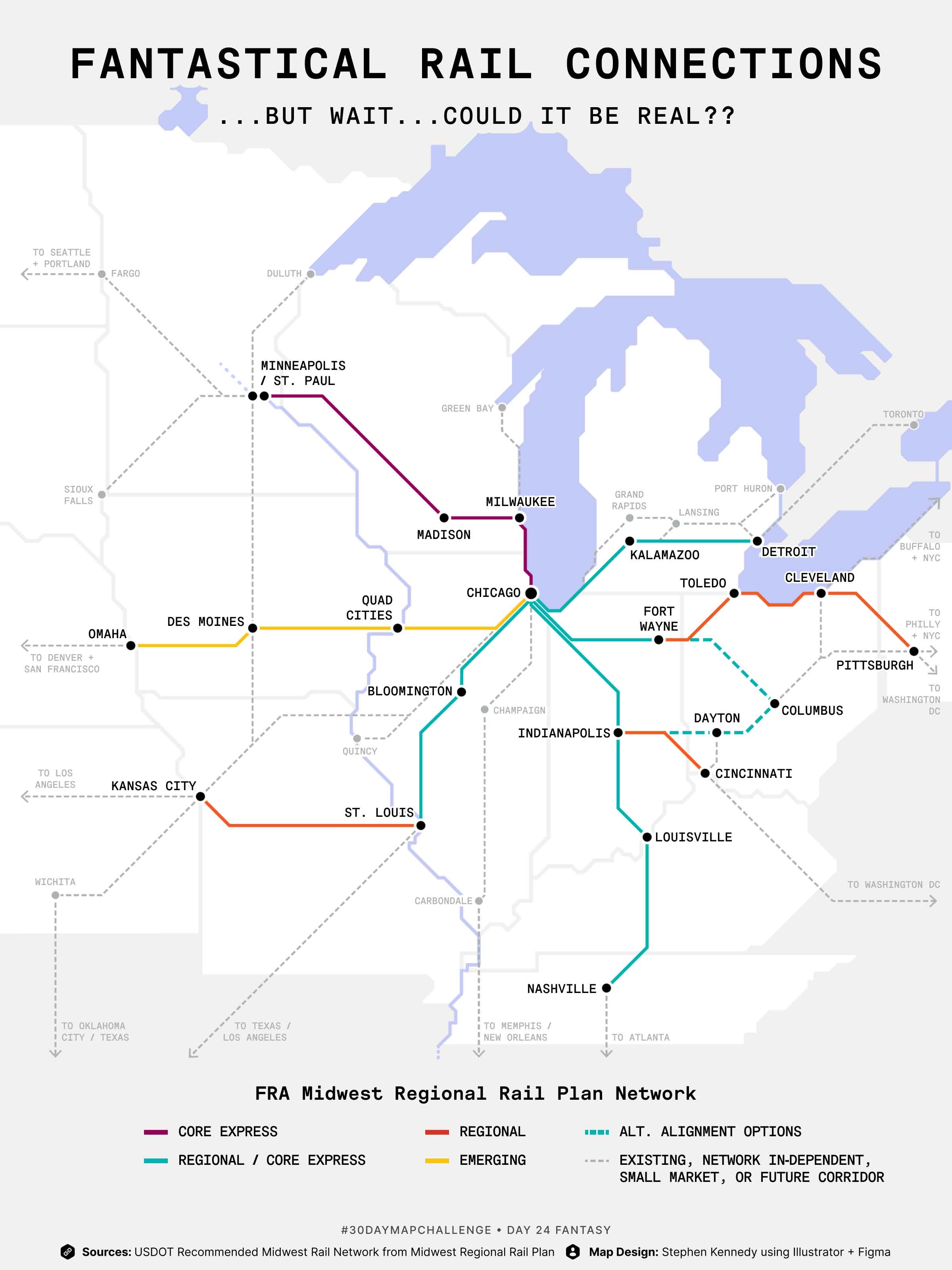
Day 24
Fantasy
Fantastical Rail Connections…but could an intercity @amtrak station in Madison WI linking to Milwaukee/Chicago & Minneapolis be a real thing?? 🙏
Tweet thread
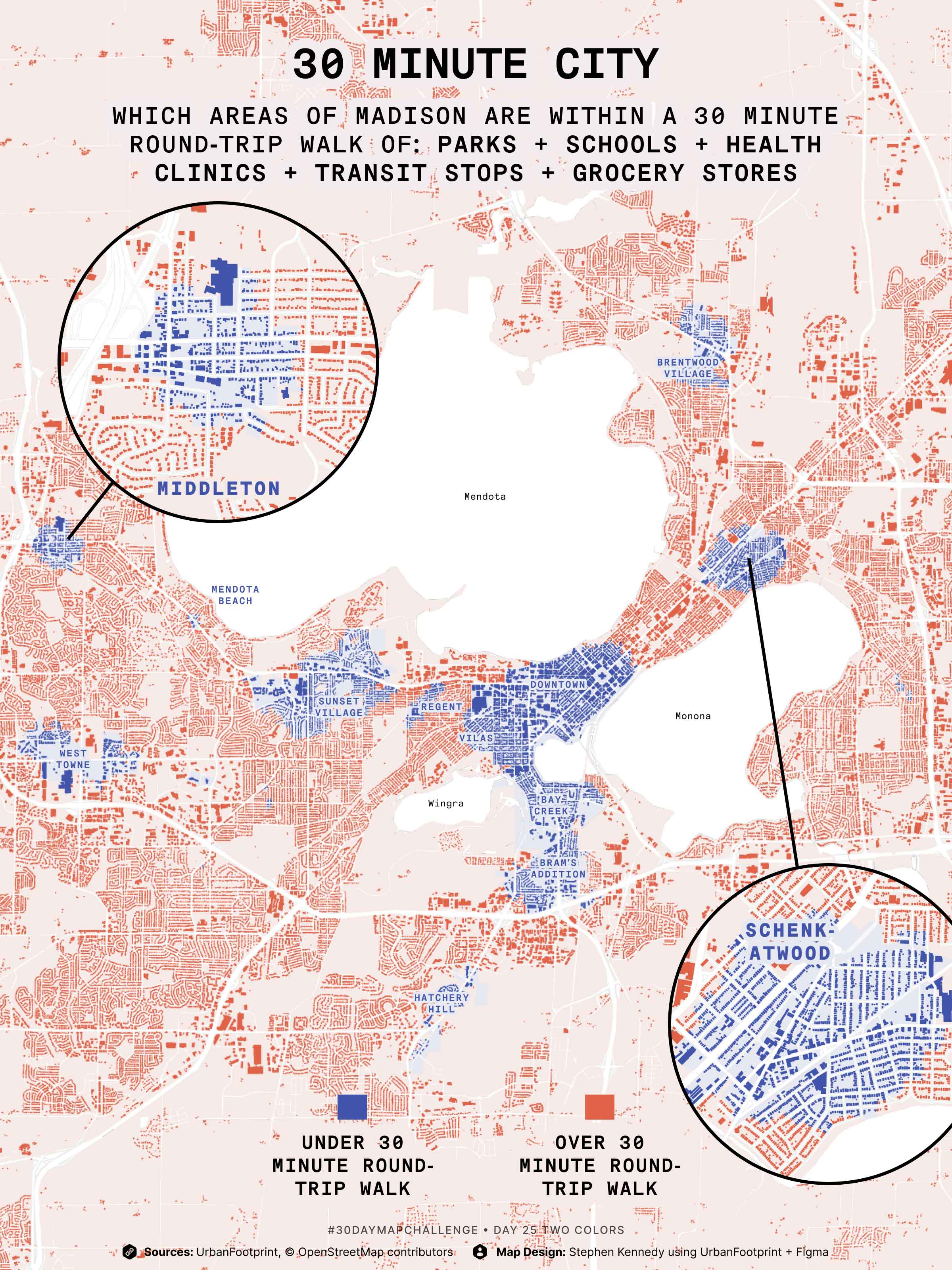
Day 25
Two Colors
🔵 Madison WI areas where you can reach ALL of these in a 30* min round trip walk:
☑️ School
☑️ Grocery Store
☑️ Hospital/Clinic
☑️ Transit Stop
☑️ Park
🔴 >30 min walk to ALL
Tweet thread
Day 26
Islands
What if, instead of a city surround by lakes, Madison was a chain of islands? Inverted lake bathymetry from @WiscLimnology and mapped using #aerialod.
Tweet thread

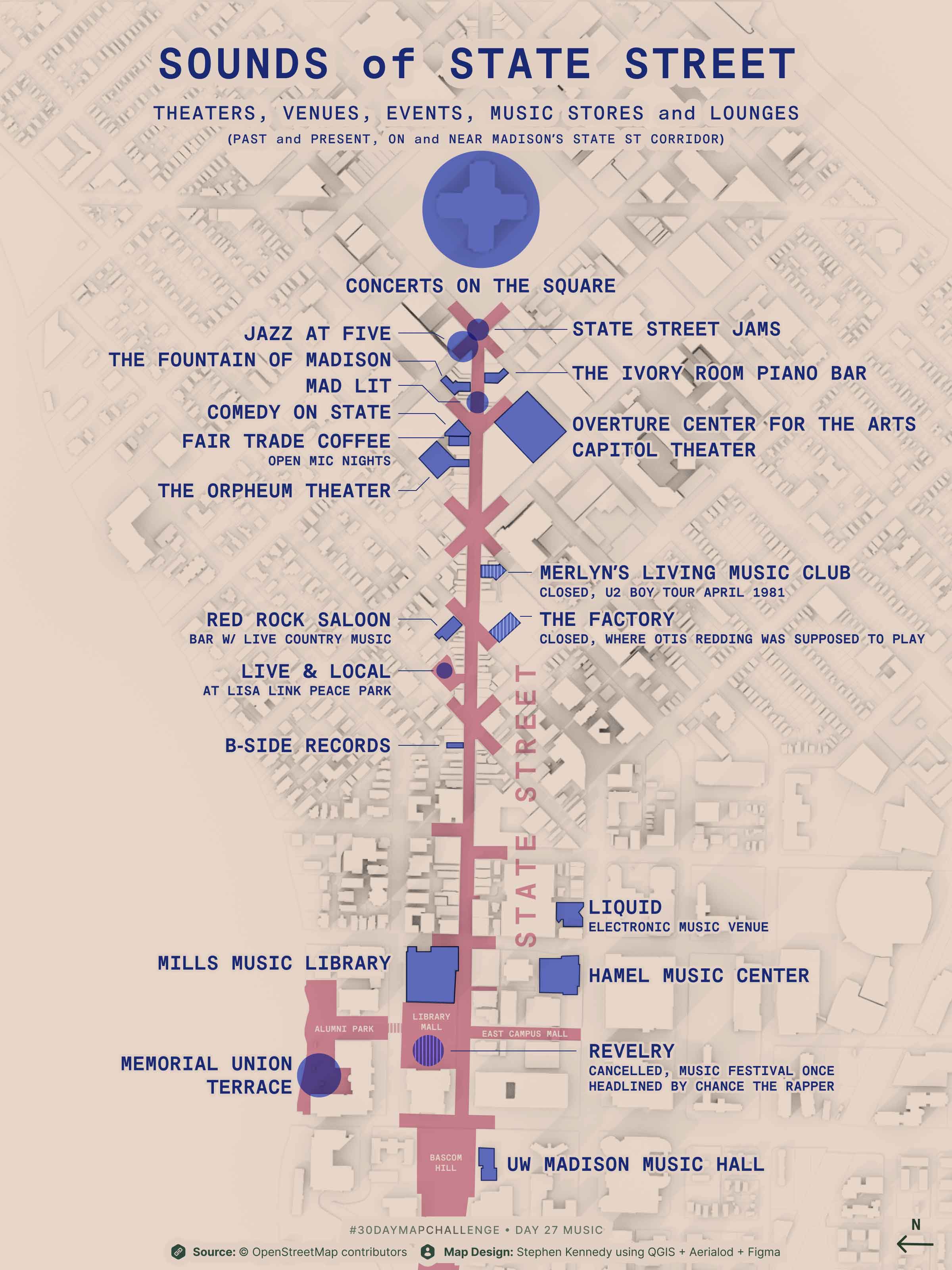
Day 27
Music
Theaters, venues, concerts, etc, past and present along Madison's State Street corridor.
Tweet thread
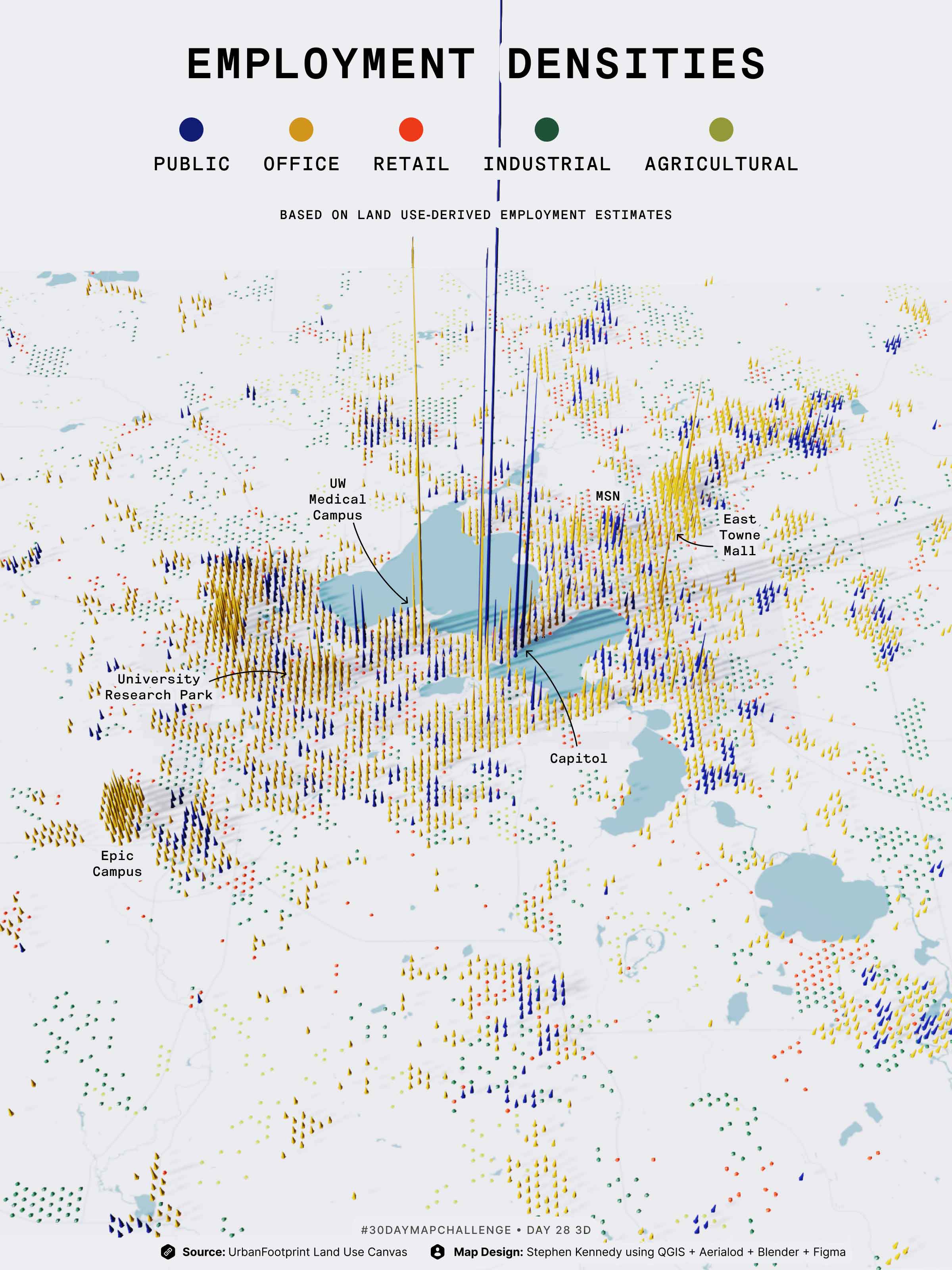
Day 28
3D
Coming in at the last minute after a lot of wrestling with #blender3d (first time!). Employment estimates by category from @UFPlatform.
Tweet thread
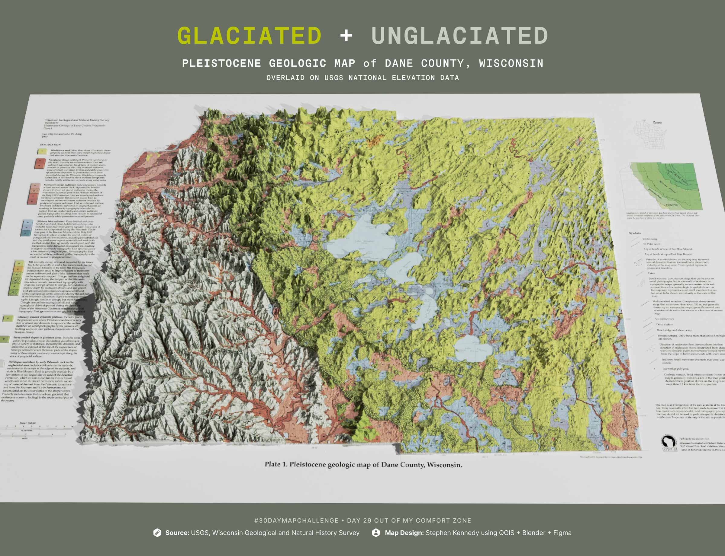
Day 29
Out of my comfort zone!
First time georeferencing a raster map from @wgnhs and overlaying it on a DEM created in #Blender3d.
Tweet thread
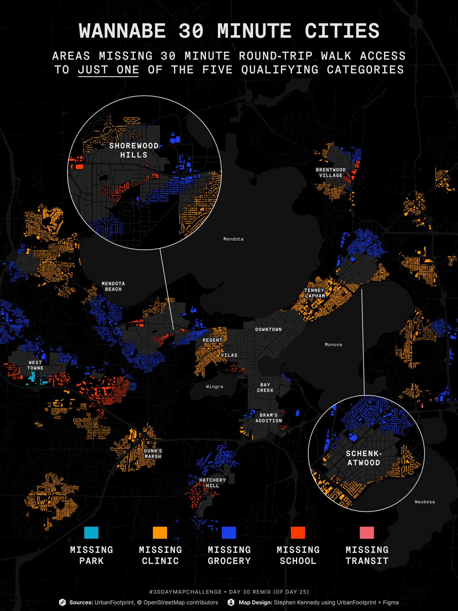
Day 30
Remix
Here’s an iteration of my Day 25 map showing places that could be 30 Minute Cities in Madison, but are missing 1 of the 5 qualifying categories. Using @UFPlatform walk analysis module.
Tweet thread