Curbs API
The future of mobility starts at the curb
Curbs are the nexus of mobility in cities, but information about the rules that govern them is difficult to obtain. Coord's Curbs API allows developers to easily understand how any stretch of curb can be used for over 200K curbs in Los Angeles, New York City, San Francisco, and Seattle.
Over the past few years, the humble curb has become one of the most hotly contested pieces of real estate in cities. In addition to long-standing demand from private cars, taxis, buses, trams and delivery trucks, now ride-hail services, bike lanes, bike-share stations, car-shares, scooters and e-bikes are also competing for use of this precious piece of concrete between the street and the sidewalk.
This increased demand often translates into congestion at the curb, which can have rippling effects on traffic flow and safety. Cities such as Washington, D.C. and San Francisco have begun looking for ways to better manage their curbs by designating select blocks for passenger vehicle pick-ups and drop-offs.
Other cities have launched programs to digitize their public street inventory, but this is typically a very costly endeavor. This is why Coord embarked on exploring more efficient ways to digitize city curbs. Our Curbs API makes this information widely available for multiple cities in a standard format, allowing software developers to easily integrate it into their applications.
Data Collection Process:
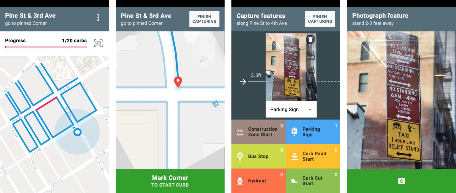
1. Surveyor App
2. Surveyor Management
3. Signage Transcription
4. Data Parsing
Surveyor App
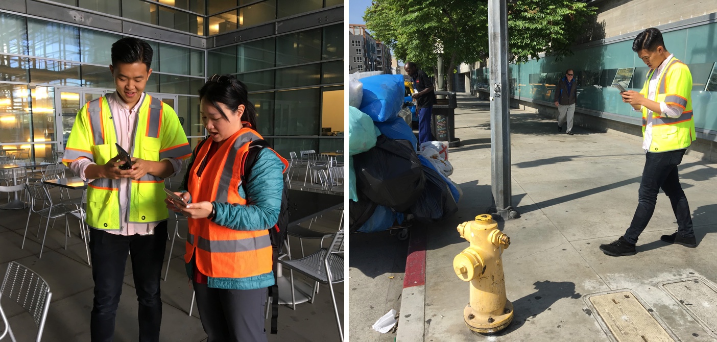
Combining Tango augmented reality technology & computer-assisted processing, we built an Android app prototype that dramatically sped up the time it takes to survey the features on a curb that dictate how it can be used.
Throughout the development process, we tested the app with internal and external users by having them go through the actual surveying process. Our goal was to decrease surveying time per curb down to 5-6 minutes.
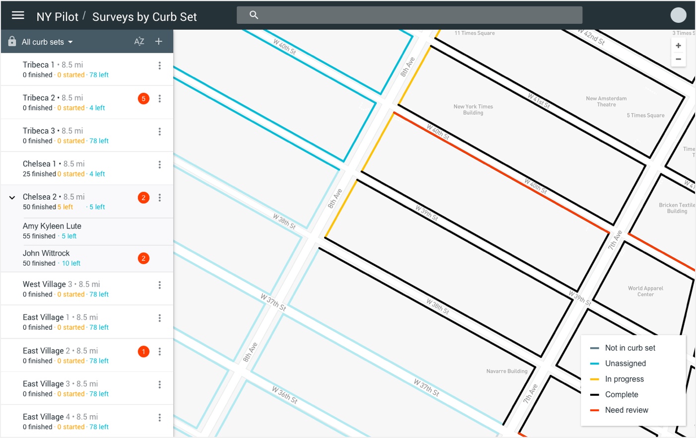
Surveyor Management
Then we built an MVP management UI that enabled us to create groups of surveyors and assign them subsets of a city's curbs. After deploying these surveyors with the Surveyor App, their progress could be tracked. As data was received, the UI also allowed us to clean up incongruencies in surveys.
Signage Transcription
We also built an MVP internal tool for the transcription of parking sign photos by mechanical turks.
Data Parsing
Location data of the physical assets at the curb, combined with the transcribed parking signs, were parsed by our engineering team into the relevant rules, translated into linear curb segments
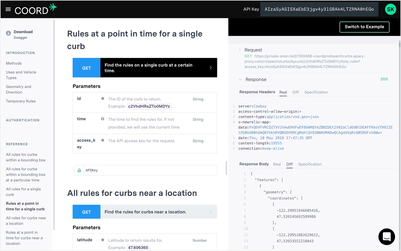
Curbs API Documentation
Good API documentation enables developers to quickly understand and test various API methods and their parameters.
As design lead, I helped with landscape analysis of developer documentation best practices, vetted documentation platforms, and tested comprehension and usability with users.
Curb Explorer
To demonstrate what’s possible with Coord's data, we conceptualized and built a web app called Curb Explorer.
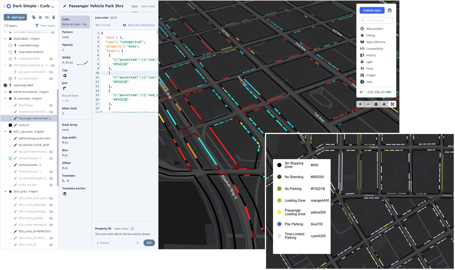
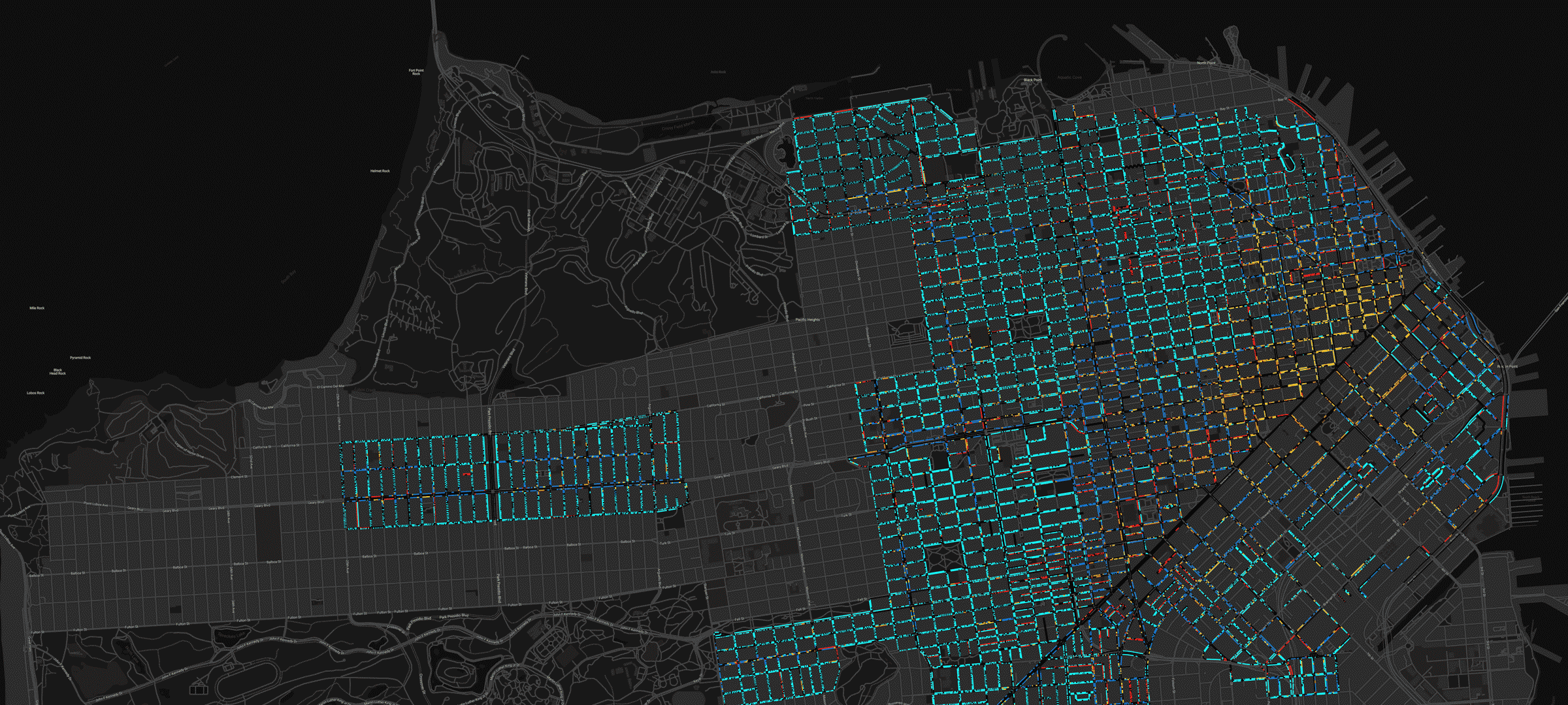
Curb Explorer displays data from the Curbs API in a filterable, color-coded map. Users can select options for vehicle type and anticipated use of the curb, such as picking up passengers or dropping off goods, to see what rules prevail at different times of day.
As design lead on the project, I facilitated interaction design of the UI, map and data styling, and user testing.
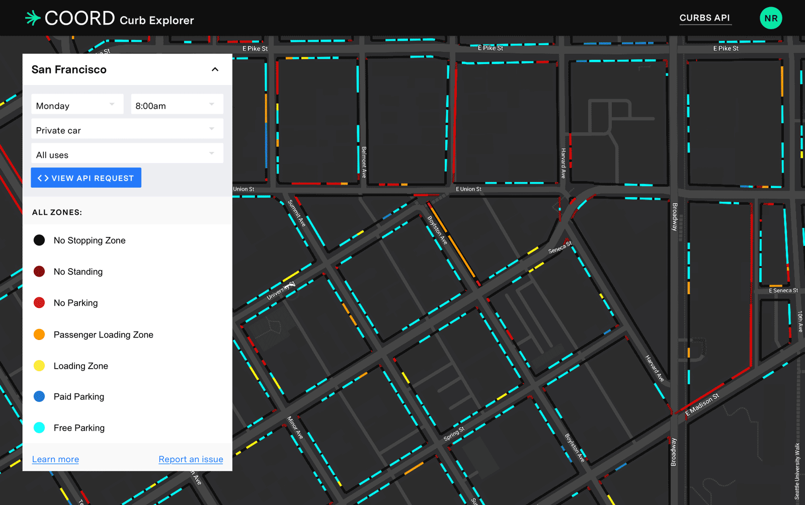
Map design
Using Mapbox Studio and the Curbs API, I explored stylization options for the curb regulation data at scale, including color blindness testing various color schemes.